Continue with onX Maps
 Sign in with Facebook


Vancouver Coast and Mountains
 BC
BC- Vancouver Coast and Mountains


Ski Lines in Vancouver Coast and Mountains - 8
Powder Project is built by skiers like you. Add Your Ski Lines


 Intermediate
Anniversary Glacier
1.1 mi 1.8 km • -2,069 ft Descent • -630.68 m Descent
 Pemberton, BC

 Very Difficult
Husume Couloir
0.6 mi 0.9 km • -1,268 ft Descent • -386.38 m Descent
Whistler, BC
 No Photos
Very Difficult
No Photos
Very Difficult
Aussie Couloir
0.4 mi 0.6 km • -1,168 ft Descent • -356.01 m Descent
Pemberton, BC
No Photos
Very Difficult
NW Face of Matier
0.2 mi 0.3 km • -661 ft Descent • -201.37 m Descent
Pemberton, BC

 Difficult
Cheques in the Mail
0.9 mi 1.5 km • -2,150 ft Descent • -655.42 m Descent
Pemberton, BC
 Difficult
Honey Bronzed and Very Desirable
1.1 mi 1.8 km • -1,252 ft Descent • -381.65 m Descent
Pemberton, BC


Vancouver Coast and Mountains Skiing
- 6 Miles 9 Kilometers of Descents
- 8 ski lines
- 1
Easy Trail

- 3
Intermediate Trails

- 9
Difficult Trails

Areas Within Vancouver Coast and Mountains
Weather Averages
|
High
|
Low
|
Precip
|
Days w/
|
| J | F | M | A | M | J | J | A | S | O | N | D |
Ascents in Vancouver Coast and Mountains - 5
Powder Project is built by skiers like you. Add Your Ascents
|
0.7
mi
1.1
km
#1Spearhead Glacier Approach
Difficult
Whistler, BC
|
Difficult
|
Whistler, BC |
2
|
|
|
3.3
mi
5.3
km
#2Winter Route to Keiths
Intermediate
Pemberton, BC
|
Intermediate
|
Pemberton, BC |
1
|
|
|
2.1
mi
3.3
km
#3Steep Peak
Difficult
Pemberton, BC
|
Difficult
|
Pemberton, BC |
1
|
|
|
1.1
mi
1.8
km
#4Peak 2318
Difficult
Pemberton, BC
|
Difficult
|
Pemberton, BC |
1
|
|
6.6
mi
10.6
km
#5Elfin Lakes Hut Approach
 Easy/Intermediate
Lions Bay, BC
|
Easy/Intermediate
|
Lions Bay, BC |
2
|
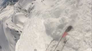
Photos of Vancouver Coast and Mountains - 21
Powder Project is built by skiers like you. Add Your Photos