
 Continue with onX Maps
 Continue with Facebook


 Intermediate

 Intermediate
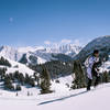
 X-Rated Couloir
0.8 mi 1.2 km • -1,891 ft Descent • -576.29 m Descent
Leadvil…, CO
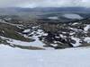
Gothic Mountain Tour
23.5 mi 37.9 km • -5,074 ft Descent • -1546.63 m Descent
Crested…, CO
Conundrum Couloir
0.1 mi 0.2 km • -448 ft Descent • -136.61 m Descent
Aspen, CO
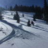
 First Glade
0.7 mi 1.1 km • -1,667 ft Descent • -508.03 m Descent
 Crested…, CO
Box Creek Chutes
Crested…, CO
Box Creek Chutes
0.8 mi 1.3 km • -1,585 ft Descent • -483.26 m Descent
Leadvil…, CO
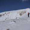
 Mt. Elbert: SE Couloirs
0.6 mi 1.0 km • -1,220 ft Descent • -371.74 m Descent


 All Clear


0 Comments