Powder Project Logo

Mount Rainier National Park

loading
Zoom in to see details
Map Key

Ski Lines in Mount Rainier National Park - 11

Powder Project is built by skiers like you. Add Your Ski Lines

Favorite Beta of the route in early March 2015
Difficult Difficult

Fuhrer Finger

0.9 mi 1.4 km • -1,963 ft Descent • -598.3 m Descent

Eatonville, WA
Explore in 3D
Favorite View of The Fly (right) and The Zipper (left and a little hidden) from the approach road.
Very Difficult Very Difficult

The Fly Couloir

0.3 mi 0.5 km • -1,097 ft Descent • -334.31 m Descent

Eatonville, WA
Explore in 3D
Favorite Those two little black dots are skiers for scale
Difficult Difficult

Nisqually Chute

1.3 mi 2.0 km • -1,992 ft Descent • -607.05 m Descent

Eatonville, WA
Explore in 3D
Favorite Beta of the route in early March 2015
Difficult Difficult

Mt. Rainier: South Face via Fuhrer Finger

6.2 mi 10.0 km • -10,462 ft Descent • -3188.68 m Descent

Eatonville, WA
Explore in 3D
Favorite View of The Fly (right) and The Zipper (left and a little hidden) from the approach road.
Very Difficult Very Difficult

The Zipper Couloir

0.2 mi 0.3 km • -794 ft Descent • -242.08 m Descent

Eatonville, WA
Explore in 3D
Favorite Skiing down the Nisqually Glacier to the bridge.
Intermediate/Difficult Intermediate/Difficult

Nisqually Bridge Run

2.7 mi 4.3 km • -2,673 ft Descent • -814.63 m Descent

Eatonville, WA
Explore in 3D
Favorite Can get nukin' in this area when conditions are right.
Intermediate Intermediate

Edith Creek

0.8 mi 1.2 km • -988 ft Descent • -301.12 m Descent

Eatonville, WA
Explore in 3D
Favorite Gibraltar Chute March 2014
Very Difficult Very Difficult

Gibraltar Chute

1.4 mi 2.2 km • -3,237 ft Descent • -986.7 m Descent

Eatonville, WA
Explore in 3D
Favorite Muir Snowfield under a full moon. Pure magic.
Intermediate Intermediate

Muir Snowfield

3.8 mi 6.1 km • -4,643 ft Descent • -1415.27 m Descent

Eatonville, WA
Explore in 3D
Favorite Great photo by Kyle Miller of the lower Van Trump area, really a mid-winter gem
Intermediate Intermediate

Van Trump Park

1.3 mi 2.1 km • -2,597 ft Descent • -791.69 m Descent

Eatonville, WA
Explore in 3D
Favorite Vik Sahney ascending an icy steep section enroute to Little Tahoma; Mt. Rainier looms in the background (Photo Credit - Gavin Woody)
Difficult Difficult

Little Tahoma via the Whitman and Frying Pan Glaciers

7.2 mi 11.6 km • -5,616 ft Descent • -1711.72 m Descent

Greenwater, WA
Explore in 3D

Mount Rainier National Park Skiing

  • 26 Miles 42 Kilometers of Descents
  • 11 ski lines
  • 0 Easy Trails Easy Trails
  • 5 Intermediate Trails Intermediate Trails
  • 9 Difficult Trails Difficult Trails
Powder Project is built by skiers like you. Share what you know about this area!

Weather Averages


High
 
Low
 
Precip
 
Days w/
 
J F M A M J J A S O N D

Ascents in Mount Rainier National Park - 3

Powder Project is built by skiers like you. Add Your Ascents

2.9 mi 4.7 km #1Mt. Rainier: Ingraham Glacier Approach
Difficult Difficult
Greenwater, WA
Difficult Difficult
Greenwater, WA
3.9 mi 6.3 km #2Muir Camp Approach
Intermediate Intermediate
Eatonville, WA
Intermediate Intermediate
Eatonville, WA
7.4 mi 11.9 km #3Wonderland to Frying Pan Glacier to Little Tahoma
Difficult Difficult
Greenwater, WA
Difficult Difficult
Greenwater, WA

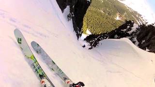
Photos of Mount Rainier National Park - 37

Powder Project is built by skiers like you. Add Your Photos

Catching some sunrise turns in on the Muir Snowfield.
Mar 25, 2015 near Eatonville, WA
Muir Snowfield under a full moon. Pure magic.
Mar 25, 2015 near Eatonville, WA
Classic early Fall conditions coming out of Pebble Creek. If you really need a fix, Muir Snowfield can satisfy your needs 12 months a year!
Mar 25, 2015 near Eatonville, WA
Be prepared for a bit of walking in the summer!
Mar 25, 2015 near Eatonville, WA
Great run down The Zipper!
Mar 26, 2015 near Eatonville, WA
Can get nukin' in this area when conditions are right.
Apr 15, 2015 near Eatonville, WA
Vik Sahney descending from Little Tahoma (note the crevasse in the background) (Photo credit - Gavin Woody)
Jul 13, 2018 near Greenwater, WA
Vik Sahney ascending an icy steep section enroute to Little Tahoma; Mt. Rainier looms in the background (Photo Credit - Gavin Woody)
Jul 13, 2018 near Greenwater, WA

Join the Community

Create your FREE account today!
Already have an account? Login to close this notice.

Get Started.