Powder Project Logo

A short but sweet descent of one of the last remaining glaciers in RMNP, in one of the park's most beautiful settings.


Your Rating: Rating Rating Rating Rating Rating      Clear Rating
Your Difficulty:
Your Favorites: Add To-Do · Your List
Zoom in to see details
Map Key

0.2

Miles

0.3

KM

Ski Line

12,205' 3,720 m

High

11,905' 3,629 m

Low

0' 0 m

Up

300' 92 m

Down

33%

Avg Slope (18°)

33%

Max Slope (18°)
Type: Backcountry or Sidecountry

Overview

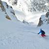
Tyndall Glacier is a 1,500' long run down one of the last remaining glaciers in RMNP.

Need to Know

In typical winter and early spring conditions, the Tyndall Glacier is very prone to slab avalanche conditions. There are regularly fresh crowns and avalanche debris on all sides of this cirque.

Description

The slope angle ranges from low 30 degrees to up to 50 degrees. While climbing up the glacier is an approach option, the easiest and most scenic option is likely the Flattop Mountain approach.

Contacts

Shared By:

Ryan Nevius

Trail Ratings

  4.3 from 3 votes

#309

Overall
  4.3 from 3 votes
5 Star
33%
4 Star
67%
3 Star
0%
2 Star
0%
1 Star
0%
Ski Line Rankings

#98

in Colorado

#309

Overall
32 Views Last Month
6,094 Since Jul 24, 2017
Difficult Difficult

0%
0%
0%
0%
75%
25%

Photos

Tyndall Glacier, from the top of the descent
Jul 24, 2017 near Grand Lake, CO
Tyndall Glacier
Jul 24, 2017 near Grand Lake, CO
loading

Weather


Current Trail Conditions

Unknown
Add Your Check-In

Check-Ins

Jun 25, 2023
P S
Mar 15, 2020
Nate Varns
Great conditions, stuck to the lowest angle, skiers left and avoided the wind loaded area. 4 places where the snow doesn't connect on the way out. 7.5mi — 9h 00m
Welcome

Join the Community

Create your FREE account today!
Already have an account? Login to close this notice.

Get Started