
 Continue with onX Maps
 Continue with Facebook


 Intermediate/Difficult
Intermediate/Difficult
Intermediate/Difficult
 Intermediate/Difficult
Land Manager: USFS - Gallatin National Forest Office
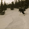
 Lick Creek Descent
0.5 mi 0.8 km • -509 ft Descent • -155.01 m Descent

 History Rock - Upper Powder Field
0.2 mi 0.2 km • -223 ft Descent • -68.1 m Descent
Mount Ellis - Direct
2.6 mi 4.1 km • -2,688 ft Descent • -819.26 m Descent
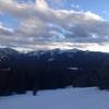
 Bozeman, MT
 Mount Blackmore - Direct
0.3 mi 0.5 km • -801 ft Descent • -244.22 m Descent
Bozeman, MT
Dirty Little Secret
0.5 mi 0.9 km • -933 ft Descent • -284.48 m Descent
Goose Creek - Powder Fields
1.2 mi 2.0 km • -1,248 ft Descent • -380.49 m Descent
Bozeman, MT


0 Comments