
 Continue with onX Maps
 Continue with Facebook


 Intermediate
Intermediate
Intermediate
 Intermediate
Land Manager: National Park Service - Mount Rainier National Park
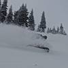
 The Fly Couloir
0.3 mi 0.5 km • -1,097 ft Descent • -334.31 m Descent
 Eatonville, WA
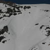
 Nisqually Chute
1.3 mi 2.0 km • -1,992 ft Descent • -607.05 m Descent
Eatonville, WA
 Van Trump Park
1.3 mi 2.1 km • -2,597 ft Descent • -791.69 m Descent
 Eatonville, WA
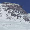
Gibraltar Chute
Eatonville, WA
Gibraltar Chute
1.4 mi 2.2 km • -3,237 ft Descent • -986.7 m Descent
Eatonville, WA
Sheep Lake Couloir
0.3 mi 0.4 km • -549 ft Descent • -167.29 m Descent
Eatonville, WA
Silver Basin
0.4 mi 0.7 km • -533 ft Descent • -162.48 m Descent
Eatonville, WA


0 Comments